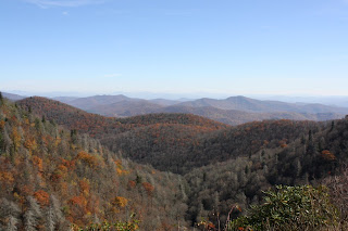
The Blue Ridge Parkway stretches almost 500 miles along the crest of the Blue Ridge mountains through North Carolina and Virginia, and is part of the National Park Service. It encompasses some of the oldest settlements of both pre-historic and early European settlement. One thing is for sure, there isn't a bad view on the entire Parkway!
(Click on photos to enlarge.)
There's a quick walk to a beautiful waterfall at
the Graveyard Fields mile marker.
This didn't look at all like the Devil to me!!
More fantastic views of the Smoky Mountains!
It didn't seem real cold today, yet there was ice
all along the Parkway.
The highest elevation (which I didn't really need to
state since it says it right there on the sign!)
Cool looking cloud - I thought it looked like a tornado!
Most of the pretty orange, red and yellow fall colors are long gone.
Everything is just kind of brown now, with just a little orange.
You can look down and see the town of Waynesville NC from this spot.
No more pretty leaves!
I know, I know - it all starts to look the same!!


